
Photo of Atlas Cosmographicae meditationes de fabrica mundi et fabricati figura (1595) taken from the collection of the Norwegian National Library - map centre - the exhibition is free to visitors
Maps are one of those rare pieces of software that almost everyone uses, yet everyone uses differently. For some they’re about getting from A to B. For others they’re for planning hikes, finding new running routes, exploring family vacation destinations, or discovering places worth visiting.
Despite spending much time looking at maps, I found myself constantly switching between apps. Google Maps for navigation, Garmin Explore for my own activities, Strava to discover routes, Norgeskart for hiking, Kommunekart for property boundaries, Iskart.no for ice conditions, and countless others for more specialized tasks. Every app solved one problem well, but fragmented and specialized for a specific task.
What really opened my eyes was discovering how much geographic data that is actually publicly available. Modern mapping is no longer just about roads and satellite imagery. In Norway alone, Geonorge publishes an enormous collection of open datasets covering everything from terrain and land cover to bathymetry and property information.
Once you stop thinking about maps purely as a navigation aid, and start thinking about them as layers of related information, they can become a playground for exploration.
Playing with map layers with a particular purpose, the first rabbit hole I fell into was bathymetry. Lakes and the dream of catching the big fish.
Bathymetric contour lines immediately tell a story. You can spot steep drop-offs, underwater shelves, submerged valleys, and shallow flats long before you’ve ever visited a lake or cast your first lure.
They’re beautiful on their own, but they can become interesting and intentionally purposeful when combined with other datasets.
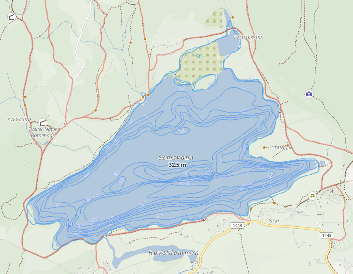
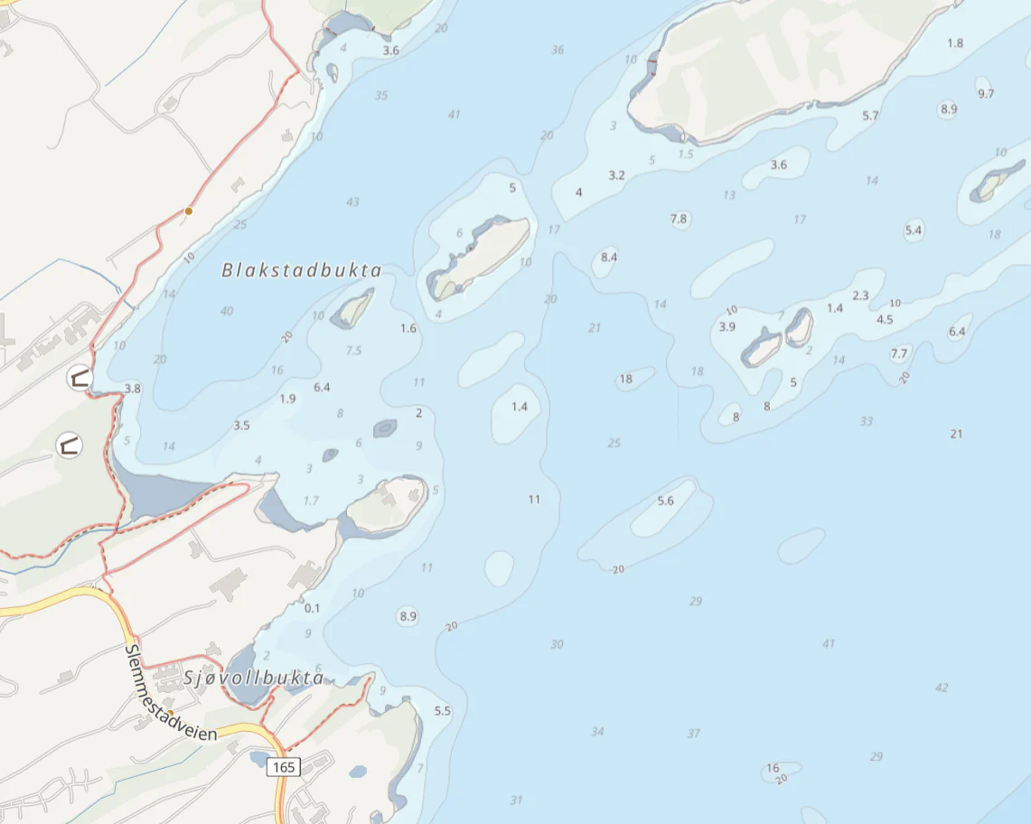
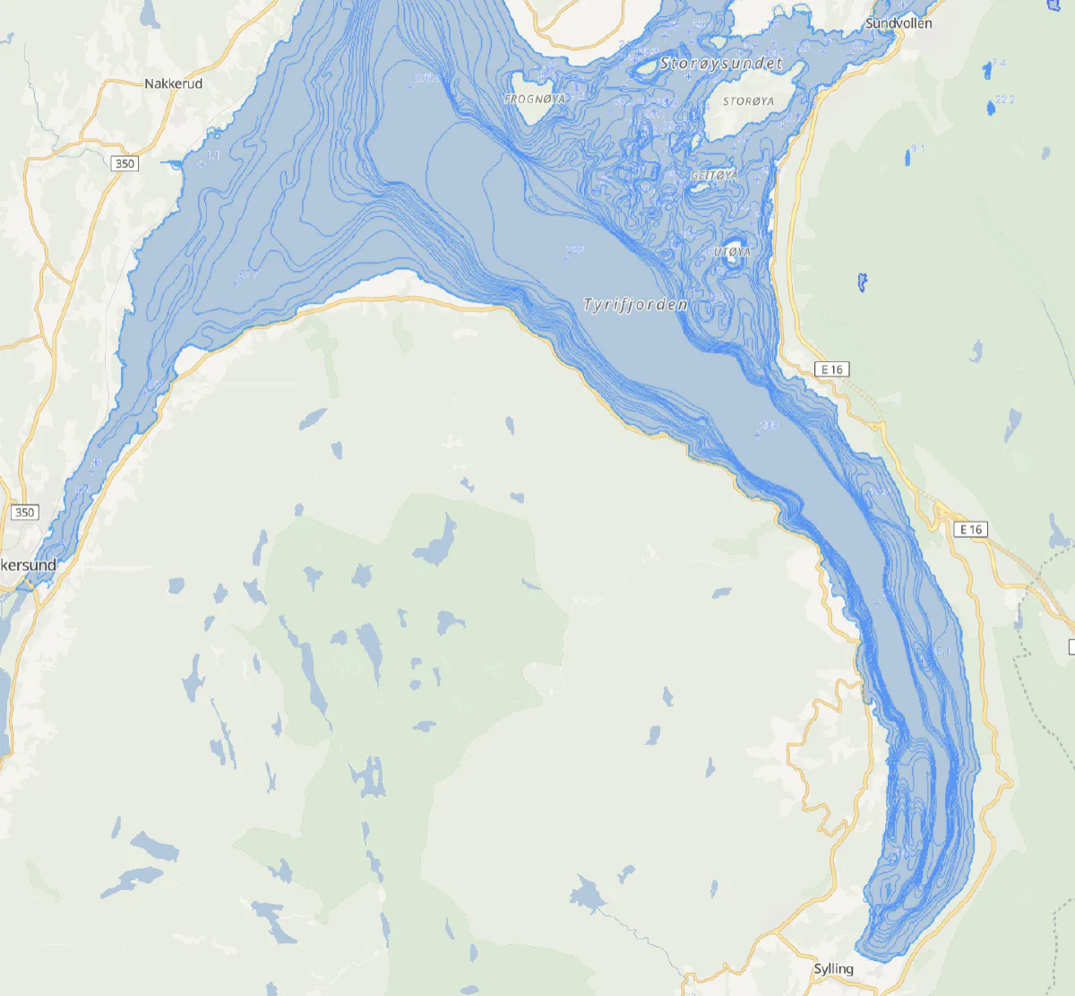
While beautiful on their own, these contour lines also give us the ability to build inferred layers, on top of the information we already have. If we were to create a lake fishing potential layer, we could start by first considering where the inlets and outlets are located. For lakes with bathymetric data, we can identify drop-offs and underwater shelves where fish are likely to gather.
Add land-cover data, and you can estimate where vegetation is likely to provide shoreline cover. Finally, add weather data such as cloud cover, wind, rainfall, and water temperature (or estimates based on air temperature), and your model becomes much more than the sum of its original data sources. You have live inputs that can change the best spots based on the current conditions.
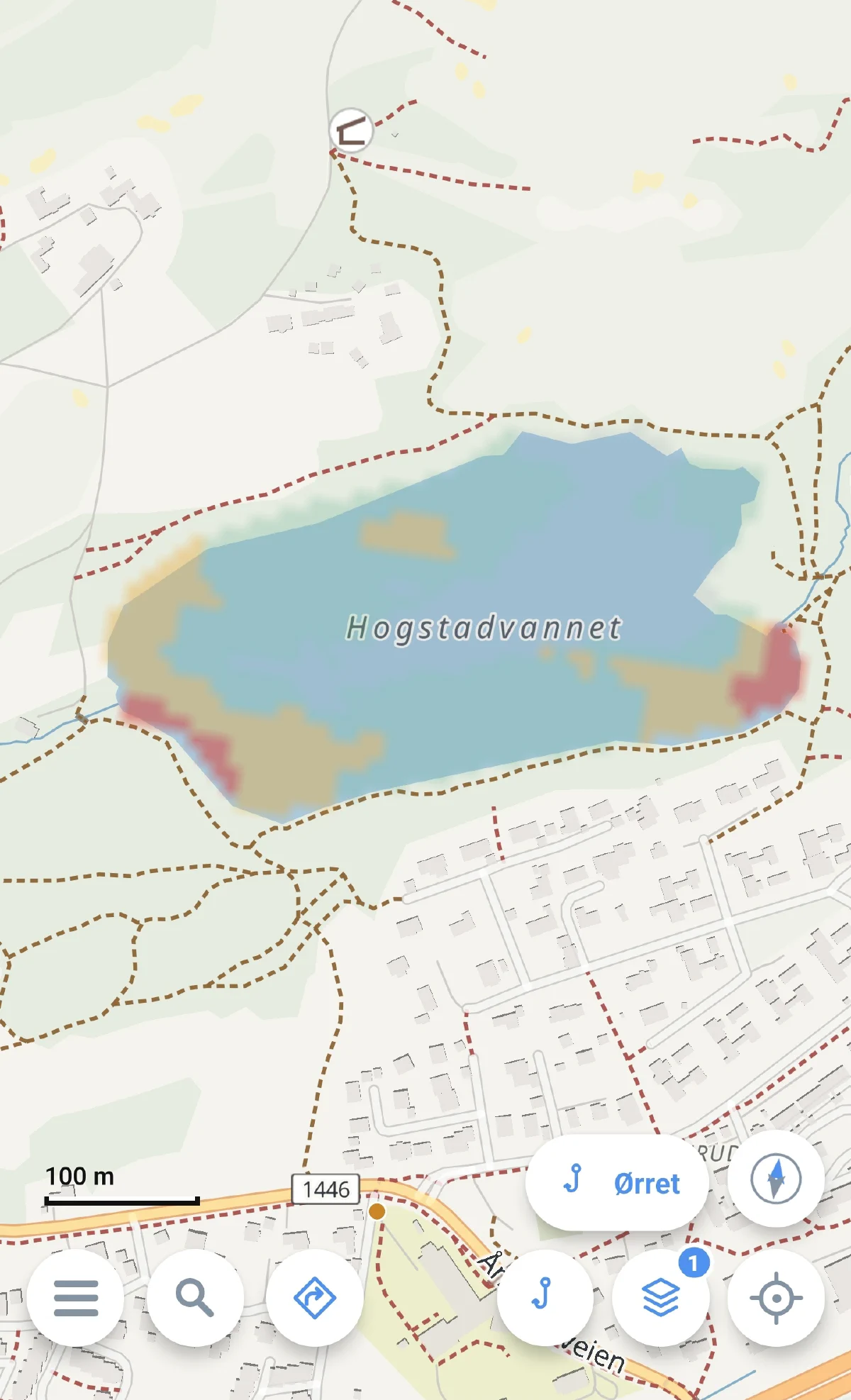
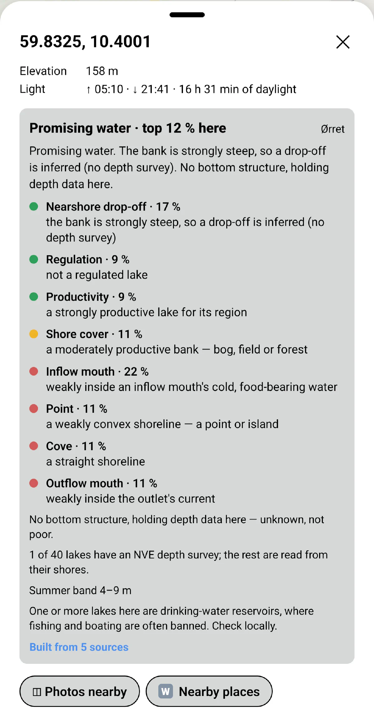
While still no closer (geographically) to the actual fish, the inertia to getting out there hopefully can be somewhat reduced as you have both theory and knowledge backing up your decisions.
Perfect for the unsuccessful fisherman dreaming of the big catch.
Comments